The Raad Ny Foillan Pilgrimage trail – in 12 sections – largely follows the Way of the Gull, the Island’s coastal path which celebrated 30 years in 2016, and includes the remains of Celtic-Norse keeills (chapels) and carved crosses found on or near the Island’s cliffs, glens and beaches. Completing the whole circuit represents a 5 day challenge of over 100 miles for experienced walkers, but its’ 12 sections allow individual stages to be explored.
SECTION 1 – DOUGLAS TO DERBYHAVEN
Excellent coastal scenery along Marine Drive to Port Soderick then inland for a short while before rejoining the coast and on to Port Grenaugh, pressing south past the Airport, to Derbyhaven – 12.5 miles.
Direction
From the harbour area of Douglas, the route takes you up onto Douglas Head with panoramic views across Douglas Bay to Onchan Head. Following the old coast road (now closed to traffic for part of its length), have a look at the folding and twisting beds of rock on Marine Drive and at Keristal which provide great views down the cliff and onto the shoreline.
Leaving the coast at Port Soderick, explore the shade of Port Soderick Glen before heading along the main road past Crogga and then back to the coast. The path has uneven stretches here as you head south – but the views up and down the coast, as you weave in and out of the bays at Port Grenaugh and Port Soldrick, alongside fields and around the headlands, are a real reward as every part of the coast gives different views.
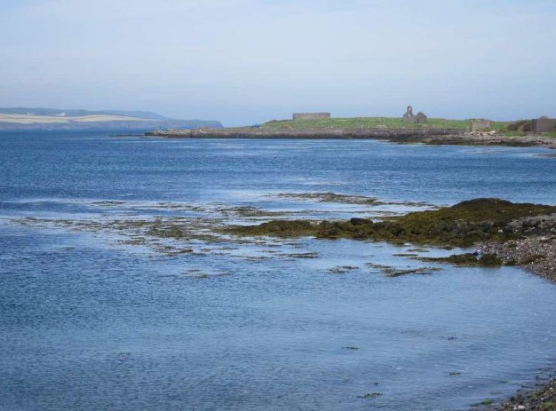
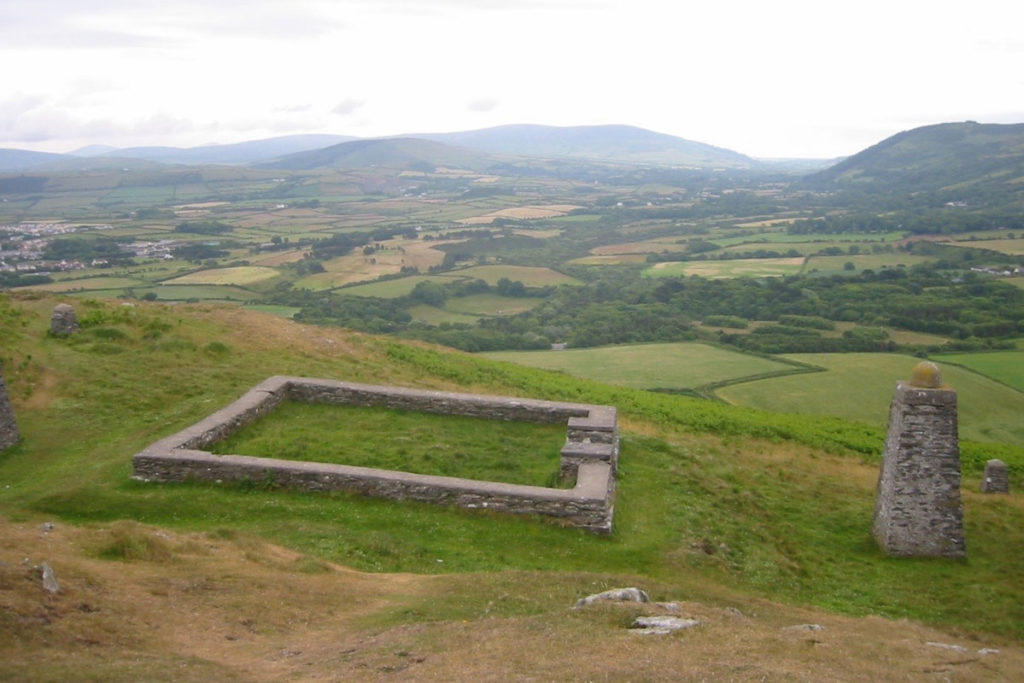
At the side of the coastal path take time to explore Iron Age and Norse promontory forts at Cronk ny Merriu and at Cass ny Hawin; and an early Christian keeill or chapel site at Ballawoods in the Santon Gorge. Take care on the path on both sides of the Santon Gorge as it can be very muddy and slippy! The chapel and fort on St Michael’s Isle / Fort Island across Derbyhaven get closer and closer on the other side of Derbyhaven Bay as you arrive on the edge of Ronaldsway airport: one of the richest archaeological landscapes on the Isle of Man, first settled over 10,000 years ago.
SECTION 2 – DERBYHAVEN TO PT ST MARY
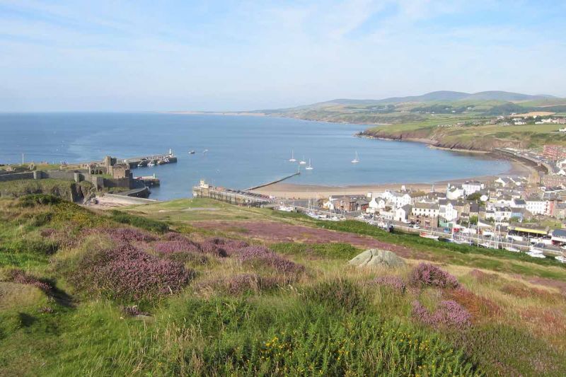
Explore the keeill and fort on Langness before walking through the ancient capital of Castletown then via Scarlett and Gansey into the sleepy fishing village of Port St Mary – 12 miles.
Direction
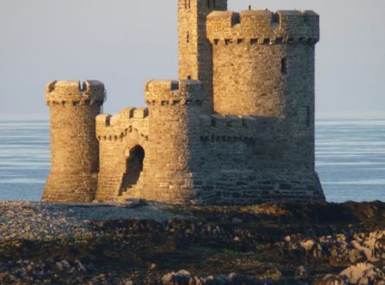
On this stretch the footpath follows the sea’s edge with views over rugged, rocky outcrops and wide, sheltered bays. There are coastal plants, seabirds and ducks in abundance. Leaving the massive Norwegian granite blocks which protect the airport’s runway extension, you head past the site of the Battle of Ronaldsway (AD 1275) and then round the shallow, sandy bay at Derbyhaven onto Langness peninsula. Make time to divert onto St Michael’s Isle / Fort Island and see the 12th century chapel and Civil War fort. There are often seals in the water here. Returning to Langness follow the signs to the eastern coast across the golf course and you’ll see the ragged fingers of rock which wrecked so many ships along this shore. Passing the lighthouse on the southern end of Langness, make your way along the road and onto the shingle beach-side path which was an early horse racing course for the Earls of Derby.
This whole area is full of history as you head towards Castletown: Hango Hill, King William’s College and then Castletown itself, the former capital of the Island with the Nautical Museum, the Old House of Keys, the Old Grammar School and at its heart – Castle Rushen. The bedrock here is limestone and as you head onto Scarlett Head there are also some volcanic stones. To your right are buildings from the WW2 radar station and then another Iron Age promontory fort at Close ny Chollagh. If you have time, take the road from Poyllvaaish to Chapel Hill, Balladoole and its Iron Age fort, Viking ship burial and Christian keeill. It has views right around the south of the Island and to Snaefell and North Barrule in the north. Back beside the sea, follow the exposed coastline around Carrick Bay to the sheltered harbour of Port St Mary.
SECTION 3 – PORT ST MARY TO PORT ERIN
Port St Mary to Port Erin – Superb clifftop walking around the Chasms to Spanish Head and down to the tip of the Island at the Sound – views of the Calf and possibly seals from the cafe! Turn north along level clifftops into Port Erin – 7 miles.
Direction
From the inner harbour in Port St Mary, walk past the outer harbour until you get to Kallow Point. If the tide allows, have a look at the fossilised tree stumps here and then visit the memorial to WW2 sailors on the Mona’s Queen. A gentle rise takes you to Perwick Bay, through Fistard village and then onto tracks across the open fields. If you have a sure foot and a head for heights stop at the Chasms and explore this spectacular area. Take your time on the footpaths and watch out for the deep splits in the rock as you head near the cliff edge to see the rock stack known as the Sugarloaf: a nesting site for kittiwakes, guillemots and razorbills. Close by, fulmars nest, and overhead you should see the acrobatic choughs. If you have time, head inland on one of the footpaths leading you to the crofting village at Cregneash and its thatched houses.
The coastal-cliff top path leads around Bay Stacka, past small stream gulleys, and then on to Black Head and Spanish Head. From Spanish Head you follow the southern coast with spectacular views over the Calf of Man, now run as a bird observatory and nature reserve. The path takes you down a steep slope and over another promontory fort at Burroo Ned to the Sound where you can enjoy the views, watch for seals at play and sometimes even see basking sharks, dolphins or porpoises. Turning onto the west coast you pick your way along the path as it rises to give a last view of the Calf of Man and then begin to see Bradda Head and Milner’s Tower, then Port Erin Bay and the village itself. On a clear day, look out to sea for the Mountains of Mourne.
Please note dogs are not permitted on the section of the footpath between the Sound and Port Erin.
SECTION 4 – PORT ERIN TO DALBY
Port Erin to Dalby – Glorious – but tough! From Bradda Head down to Fleshwick then up and down again to the Sloc before climbing to the summit cairn of Cronk Ny Irree Laa with extensive views over the whole island – then down to Dalby village – 9.5 miles.
Direction
This stage of the walk takes you along the west coast through some superb moorland walking. Spectacular in mid to late summer when the heather and gorse are in bloom, the route takes you up (and down!) a series of hills on coastal and cliff footpaths. Starting in Port Erin by the old Marine Biological Station, follow the lovely horseshoe bay around to Bradda Glen, Bradda Head and the commemorative Milner’s Tower. The remains of lead and copper mines are all around you as you head on towards Bradda cairn.
Catch your breath and look back for views south to the Calf of Man. A steep descent (through waves of bluebells in spring) leads you to the isolated bay at Fleshwick. Across the stream at the bottom you begin a steady climb up the footpath onto Lhiattee ny Beinnee. Turn and look back every so often to be rewarded with fine views over Bradda Head and then also over the Calf of Man.
Soon the views northwards open up past Cronk ny Irree Laa to Niarbyl and Peel Hill behind. To the north east is the highest peak in the south of the Island: South Barrule, with an Iron Age hillfort on top. Drop down to the picnic tables at the Sloc for a welcome rest! The next stretch takes you steadily uphill to the summit cairn on Cronk ny Irree Laa with extensive views over the centre and north of the Island, then down a steep uneven path heading northwards. The marked route takes you right down to the coast path, but in bad weather take an inland route past Eary Cushlin. (For those with plenty of time, carefully take the path to the chapel site at Lag ny Keeilley and then back to the Raad ny Foillan). Bothpaths lead you towards the lovely bay at Niarbyl with spectacular views down the coast back to Bradda Head and the Calf of Man.
It is important to check weather forecast before setting off as visibility can be poor in bad weather.
SECTION 5 – DALBY TO PEEL
Soon into Glen Maye where we follow a wooded path down to the beach. Follow the cliff path, enjoying more fine views all the way over Peel Hill, then down into the town – 6 miles.
Direction
From Niarbyl follow the main road north towards Peel past the mounds which were once housed equipment for a radar station, along the way-marked route which takes you down a footpath and track following the coast along to Glen Maye. Take time to explore the glen, where you will find the stone wheelcase of a water wheel used in lead mining, and higher up the lovely deep wooded glen and the stunning waterfall. These are not to be missed.
Then follow the north side of the glen and return to the open coast. The rest of the route to Peel is an undulating cliff top path which winds in and out along the coast across stiles and field boundaries, with views down to each bay and inlet and with the prospect of Peel Hill and Corrin’s Tower getting ever closer. On this coast it’s as if the rest of the Island doesn’t exist. Passing Knockaloe on the right, with views up to St John’s and Tynwald Hill, you can choose to follow the coastal path round Peel Hill and Contrary Head or head up to Corrin’s Tower and over Peel Hill itself. The reward for the end of this stage is the gradually emerging view over Peel Castle, the harbour and to Peel and its lovely sandy beach. When in Peel explore Peel Castle, the House of Manannan, The Leece Museum, St German’s Cathedral, Moore’s Kipper Yard and lots more.
SECTION 6 – PEEL TO KIRK MICHAEL
Much of this section follows the route of the old Manx Northern Railway, passing through the scenic Glen Mooar and Glen Wyllin. A short hop takes us into Kirk Michael with its fine crosses and memorials in the parish church – 7 miles.
Direction
From Niarbyl follow the main road north towards Peel past the mounds which were once housed equipment for a radar station, along the way-marked route which takes you down a footpath and track following the coast along to Glen Maye. Take time to explore the glen, where you will find the stone wheelcase of a water wheel used in lead mining, and higher up the lovely deep wooded glen and the stunning waterfall. These are not to be missed.
Then follow the north side of the glen and return to the open coast. The rest of the route to Peel is an undulating cliff top path which winds in and out along the coast across stiles and field boundaries, with views down to each bay and inlet and with the prospect of Peel Hill and Corrin’s Tower getting ever closer. On this coast it’s as if the rest of the Island doesn’t exist. Passing Knockaloe on the right, with views up to St John’s and Tynwald Hill, you can choose to follow the coastal path round Peel Hill and Contrary Head or head up to Corrin’s Tower and over Peel Hill itself. The reward for the end of this stage is the gradually emerging view over Peel Castle, the harbour and to Peel and its lovely sandy beach.
When in Peel explore Peel Castle, the House of Manannan, The Leece Museum, St German’s Cathedral, Moore’s Kipper Yard and lots more.
SECTION 7 – KIRK MICHAEL TO JURBY
Kirk Michael to Jurby – Much of this section follows the shingle beach – enjoy the company of oystercatchers and gulls and leave the shore at Sartfield en route to Jurby – 7 miles
Direction
From Glen Wyllin Campsite, head north again on the old railway line through the cutting to Rhencullen. The route then tracks across small fields and lanes to Glen Trunk and the sea.
Some coastal erosion may make the access hard here so take extra care and follow any changes in routing which the ‘Raad ny Foillan’ signs indicate.
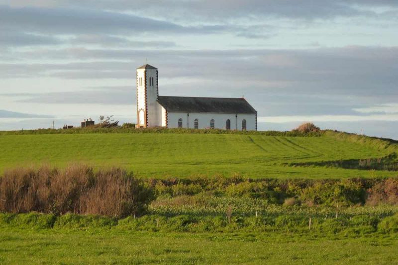
If you are taking the beach route, check the state of the tides to ensure safe access. For the rest of this stage your feet are on sand and shingle, which can be soft and hard-going in places, but wet sand near the sea’s edge usually gives the best grip. Watch out for stream crossings especially at high tides. There are naturally sculpted patterns in the layers of sand in the eroding cliffs and the clay lying at their base. Apart from occasional dog walkers, your main companions will be oystercatchers and gulls. Leaving the beach at Sartfield gives access to Jurby – where St Patrick’s Church and the nearby Isle of Man Motor Museum and Jurby Transport Museums are well worth visiting
SECTION 8 – JURBY TO POINT OF AYRE
Jurby to Point of Ayre – Beach walking all the way here, crossing the Lhen Trench and looking out for a variety of birdlife – and you’ll be on sand and gravel deposited after the Ice Age! Strong currents gather as we approach the Point of Ayre – 8.5 miles.
Direction
From Sartfield you head along the beach on sand and shingle for virtually the whole route. If that is too hard going for you, then at the Ayres it is possible to come a little inland and follow one of the many paths which run parallel with the beach amongst the lichen heath – an unusual mix of heather and lichens.
This whole area is rich in birdlife and care should be taken to avoid disturbing birds during the nesting season (especially the arctic terns!). The sands and gravels you see were deposited by retreating glaciers at the end of the last Ice Age and they are now being eroded by the waves and then redeposited to the north and east of the Island.
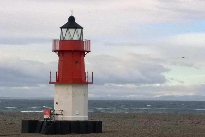
Take care crossing the Lhen Trench, especially near high tide as the flow of water can be strong. The Point of Ayre lighthouse at the northernmost tip of the Isle of Man is a real landmark with the rounded ridges of shingle banks all around it.
Please check tide timetable before setting off as access is restricted in high tide.
SECTION 9 – POINT OF AYRE TO RAMSEY
Heading south along the beach with the impressive steep cliffs of the Bride hills on our right, and underfoot stones carried here from England, Ireland and Scotland by ancient glaciers. Fine views of Maughold ahead, as we approach Ramsey – 5.5 miles.
Direction
Before starting out, check that the tides allow safe passage for walking this stage on the beach. The whole route is mainly on sand with some shingle, birds and the occasional seal as your companions. You will be walking near the foot of the impressive sand cliff of Bride and Shellag Point, deposited thousands of years ago by glaciers of the Ice Age.
Don’t go too close as they are actively eroding but enjoy the patterns in the sand and the underlying clay. On the beach you will find water-worn lumps of granite, sandstone, limestone, small pieces of flint and other rocks carried here from Ireland, Scotland and England by the glaciers. Gradually Maughold Head, Ramsey and North Barrule come closer into view and you reach Ramsey and its North Promenade. Take time to explore Mooragh Park, Ramsey Harbour and the town itself.
SECTION 10 – RAMSEY TO MAUGHOLD
From Ramsey we follow the Coastal Footpath to Port e Vullen then fine clifftop walking – often in the company of seabirds – all the way into Maughold, with its church and fine crosses – 4.5 miles.
Direction
From the harbour or the south promenade in Ramsey head south and past Ballure. The route now follows the main road until you reach the A15 road to Maughold on the left. Follow this down over the electric railway line at Bellevue and you reach Port Lewaigue and Gob ny Rona. It is well worth spending time here looking back at the sweep of Ramsey Bay and the route that you have taken along the coast from the north.
Continue on the coastal path – but be aware that the coastal route at Port-e-Vullen is restricted at high tide and you may need to continue along the A15 towards Maughold to take an inland path across Gob ny Rona. At Port-e-Vullen there is a short stretch on the road and then you follow a path back to the coast via a kissing gate. From here you are on some of the Isle of Man’s best coastal cliff walks as you head onto Maughold Brooghs, and in spring when the gorse and the bluebells are blooming it is breathtaking.
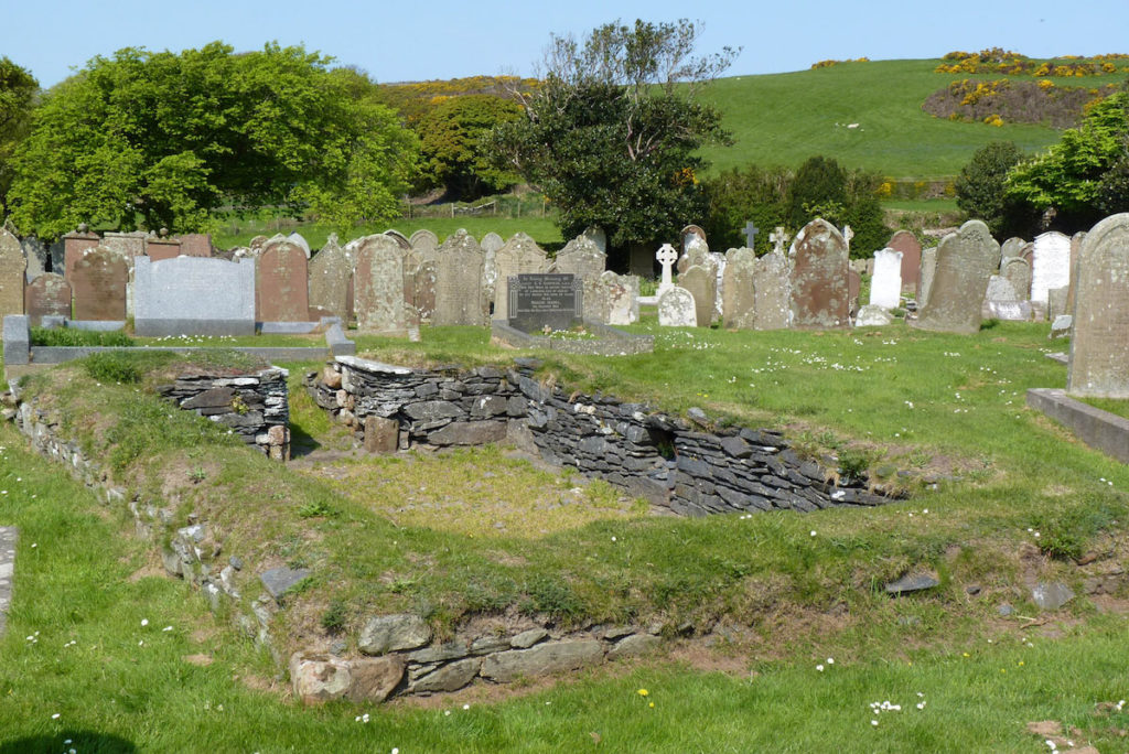
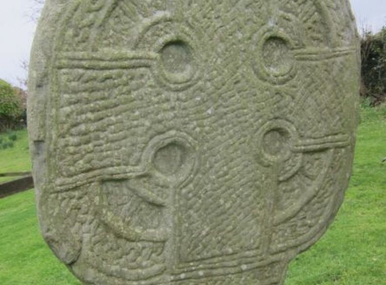
You walk past mining remains and a view point on the top of Maughold Brooghs, then on towards Maughold Head and to the edge of Maughold Village. Take time here to explore Maughold Church, Churchyard, Ancient Keeills and the Cross House which has the largest collection on the Island of decorated stones and memorials from the Island’s Celtic and Norse Christian past.
SECTION 11 – MAUGHOLD TO LAXEY
Around the coast to Port Mooar then climbing inland to enjoy fine views from the Quaker Burial Ground then down through the Cornaa valley to the beach before climbing to cross the Electric Railway line and on to Laxey – 8.5 miles.
Direction
If you didn’t take the opportunity to explore Maughold Village, Church, Churchyard and Cross House have a look before you start today. Your route then takes you on a farm track, past a lime kiln and then down to the coast near where mining for iron ore took place. Follow the path right by the coast and enjoy views back to Maughold Lighthouse. As you make your way into Port Mooar, heavy erosion makes the path hard to find and sometimes very wet. From Port Mooar you come inland to follow country roads that rise up above Ballafayle.
Take time here to explore the Neolithic Burial Cairn, the Quaker Burial Ground and the memorial to Sir Charles Kerruish which gives stunning views back over Maughold Head and beyond to the Lake District and Cumbria. As you head downhill, take in the view of North Barrule and the ridge that leads to Snaefell. Head down the Cornaa valley, passing the bellite works, to the shingle banks at Port Cornaa then follow the country road towards Dhoon Glen and if time allows explore the glen – or look for the electric trams which run on the track beside you. Climbing up and across the railway and main road you reach the Ballaragh Road heading for Laxey. Views across Laxey Bay, and then of Snaefell, begin to appear. A steep descent leads you to Laxey harbour: a small fishing harbour from which the lead and zinc of the Great Laxey mines was shipped to South Wales for smelting. There is a heritage trail following the Laxey river which leads from the harbour up to the Great Laxey Wheel: the largest working waterwheel in the world.
SECTION 12 – LAXEY TO DOUGLAS
On the coast road, then down to Garwick, and onwards to the delightful St Adamnan’s church. Then along a quiet road before descending to Groudle beach and over Onchan Head with views of Douglas opening up before us – journey’s end! – 9.5 miles.
Direction
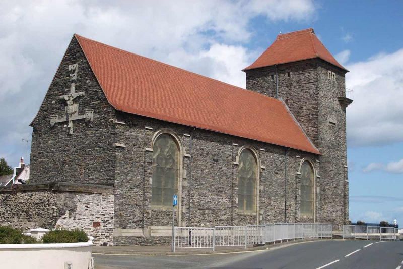
Start your journey on Laxey Promenade following the Raad ny Foillan signs which lead you steeply up the footpath to the narrow road joining the main road south. As you come towards Baldrine the path leads you right down to the sea at the isolated cove at Garwick Bay. The route then takes you through part of Baldrine and through the Ballanette Reserve which you are welcome to explore for its wildlife and views over the sea and up to Snaefell. Heading south, the road leads you near Lonan Church, St Adamnan’s, a lovely little chapel with the only 10th century decorated cross in its original position on the Island, a stone with intricate interlaced decoration.
The route drops down into Groudle Glen and then follows the route of the Electric Railway before passing beside the modern homes on Onchan Head with their extensive views over Douglas Head and Douglas Bay. After Port Jack the path leads down onto Douglas Promenade itself and a return to the traditional starting point of the Raad ny Foillan at Douglas harbour. Look out for the Manx Electric Railway Line and station and the horse tram lines. Many of the buildings you pass were built as 19th and 20th century hotels, guest houses, places of entertainment or the more modern redevelopments all sitting alongside this glorious sweep of a bay. Near the harbour in Douglas Bay is the Tower of Refuge: built in 1832 as a place of safety for sailors shipwrecked in the entrance to Douglas Harbour.
Pilgrimage Isle Of Man
Sitemap / XML
Funded by Arts and Humanities Research Council www.ahrc.ac.uk